Dec 29, 2012

My First 7k Running

I got a pair of running shoes. The brand is Adidas,"Adizero Boston3" for beginners. It has wide last, so it really fits my feet.
I ran 3k and climbed Mt.komaki(86m), and more 3k. Running makes me feel great, so I would like to work my way up and participate in a full marathon next year. 
ランニングは気軽にできていいですね。来年のフルマラソン参加を目標に続けてみます。

Dec 17, 2012

津〜伊勢神宮 / Winter riding

It's already December. I feel like that I just got into 2012 though. Time fries doesn't it?
We had a winter ride from Tsu-city to Ise Jingu. We started out from friend's house in Tsu. And we could ride with the wind, so it took an hour and a half in 50K. Relaxed smile!
10:30am, many people were there.
And of course, we had Ise-UDON. It was a simple, but so delicious. 
Someone's cool bike; Derosa Neo-primato.

The whole way back, the strong wind was against us. So we took three hours! It was so hard!
津から伊勢神宮まで行きましたが、行きは1時間半、帰りは3時間!かかりました。冬はきついかも。 


Nov 18, 2012

秋波 / Autumn swells

We went surfing. Low-pressure swells hit Irago Coast. I think swells were almost head high at 7am.
  
My friend's board(7'6) that sold for ¥6,300(like $80) at a secondhand store. But this was a comfortable board to ride on. It means that the most important thing is "the Riding quality", not "the Price".  

Nov 11, 2012

香嵐渓 / Autumn color Riding

7am, It looks like rain.
It's a coffee break.
Keep on climbing...
My friend's bike "IF Ti Crown Jewel". So cool!
What a wonderful color! But a little bit early.
11am, it started raining. We desired something hot to drink. Hard and cold riding, but I truly enjoyed it.

Oct 8, 2012

仙丈ヶ岳 / Mt. Senjyogadake

夜中2時に名古屋をでてバス乗り場に5時30分着。写真は仙流荘前のバス乗り場。かなり混雑。
 でも鋸岳が奥にはっきり見えるほど天気は良くて眺望は期待大。
北沢峠に7時30頃到着し、テント設置。今回は甲斐駒とセットで昇る予定であった為、ベースキャンプ風。
仙丈ヶ岳に登っている途中の紅葉。
サントリー南アルプス天然水の水源地、甲斐駒ヶ岳。(Mt. Kaikomagadake)
馬の背ヒュッテ、辺り一面まっ黄色。
仙丈小屋に続く稜線歩きはこんな感じ。
稜線上のナナカマド、まっ赤。
仙丈小屋を横目に見ながら、頂上と薮沢カール。雲行きが...
そして頂上。やはり眺望はゼロ。しょうがないです。
 なんだかカーブが綺麗な小仙丈沢カール。
そして、夜中からずっと雨降りの為、次の朝は甲斐駒に登らず撤収。まあ次回です。
We went to the South Alps of Japan for our first mountain camp. We were planning to climb Mt. Senjyogadake and Mt. Kaikomagadake over two days. But after first climbing, we caught in the heavy rain through the night and into the morning. So we canceled the second climbing. These pictures are first mountain's(Mt. Senjyogadake). We enjoyed changing colors of autumn leaves. So beautiful! See the next climb. 

Sep 11, 2012

Bicycle ride(薮原駅〜乗鞍〜高山駅)

今回は久しぶりの輪行。中央本線の薮原駅から乗鞍(畳平)を経由して高山駅までの走行距離110km。名古屋駅からAM6時12分発中津川行きに乗り込み、途中乗り換えて薮原駅到着はAM9時30分頃。乗り換え後は立ちっぱなし。しかもワンマンカーなので降りる際は混雑している中をバッグ抱えて一番前の扉まで行かなくてはダメです。気を使うし、この段階ですでにグッタリ。
My heart desired a sense of accomplishment, so I planned the cross a mountain by bicycle. Fortunately, my district is relatively close from the Japanese Alps.I can reach the bottom of major mountain within 3 or 4 hours by train or car.This time, I wanted to go to Mt. Norikura, because it has the highest mountain pass in Japan. So I figured it would be the perfect place for enjoying a sense of accomplishment. I got on a first train from Nagoya Station to Matsumoto. In Japan, you can carry a bicycle on the train at no additional cost, but you must put it in a bag.
薮原駅をAM10時に出発。
I started out from Yabuhara Station at 10AM.
しばらくは26号線を北上。乗鞍の天気はどうかな?
Ride up to Norikura! How is the weather?
本日1つ目の峠(境峠)。松本市に入ります。
First mountain pass, I'm going to enter Matsumoto City.
 
ここから左に曲がって乗鞍高原まで20km。
I turn left to Norikura-kogen Heights.
2つ目の峠(白樺峠)を越え、乗鞍高原手前から望む乗鞍岳。ちょっと雲に隠れてますね〜。
I pass the second hill of this route. I can see Mt. Norikura, but it's cloudy.
そして乗鞍高原到着、涼しいし良いところです。山小屋の人に聞いたら、ここから畳平までチャリで2時間だって!?足もつか?オレ。 Here is Norikura-kogen Heights. I have to climb another two hours. I feel tired.
それでも登らないと帰れないので、高度を上げていきます。
But I can't go home if I don't make it over this mountain.
バスも登ってきます。3台写っていますが、下のバスが僕の所に来たとき、その運転手さんが「すぐそこにクマがいたから気をつけて!」だって。足も売り切れているのに気をつけてと言われてもね〜。
The bus driver told me " There is a bear in the vicinity! Take care!" "Oh! I don't want to encounter the bear!"
とかなんとかでPM4時30分頃、乗鞍畳平に到着、天気良し。でもクマが怖いのでそそくさと退散。ちなみに手前の袋みたいな物はバックパックです。最近気に入っているHyperlite Mountain Gearのもの。
Finally, I reached the top of Norikura Sky Line at 4:30PM. It was nice weather, but I must leave in a hurry. Because it was somewhat behind schedule and I feared the bear.
下っている途中で見えた穂高岳など。登りたいけど、今年は無理かな〜。来年ですね!
距離約50km、至福のダウンヒルを終えて、高山駅到着はPM6時15分。合計8時間15分!今回は峠が3つありとても走りがいのあるルートでした。輪行はやっぱりちょっと面倒でしたが、天気が良かったのでそれもしょうがないですね。
I could see Mt. Hodaka-dake during my down-hill from Mt. Norikura. I will climb Mt. hodaka-dake next year! After the long distance down-hill, I arrived at Takayama Station at 6:15PM. I was so tired, but this route was amazing. And I had a great sense of accomplishment. See the next ride!

Jul 22, 2012

Mt. Ontake / 御嶽山


We climbed Mt. Ontake. It is one of the 100 most famous mountains in Japan. The start of the trail is 2,180 meters high at Tanohara National Park, and you will climb about 3.5 kilometers to the top of the 3,067 meters high. We started climbing at 10am.
日本百名山の御嶽に登ってきました。標高2,180m地点にある田の原天然公園の登山口から3.5km登って3,067mの頂上に着きます。午前10時登山開始。
But the weather was bad, so we didn't expect a nice view.
天気が悪かったので、景色は期待しませんでした。
For a moment the clouds drifted away, the snowy gorge around 2,700 meters high was all white in sunlight.
一瞬雲が切れて、2,700m付近の雪渓が太陽に照らされて真っ白になりました。
 By chance we met the grouse that is designated as a Special National Treasure. 
偶然にも特別天然記念物に指定されているライチョウに遭遇。
 
The clouds screened out all views, so this chance of prospects was the first time and the last time. 
雲が分厚くて、この眺望が最初で最後でした。
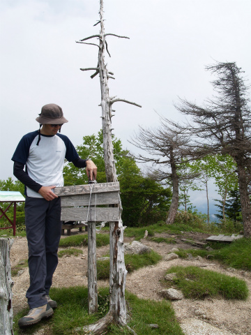
 
We kept climbing for three hours, we reached the summit of Mt. Ontake. No prospects.
3時間登り続けて御嶽の頂上到着。眺望ゼロ。
It is worth while climbing this mountain. I'll go to climb again soon.
よい山なので、またすぐ登りに行くつもりです。

Jun 20, 2012

Mt Ohkawa-iriyama / 大川入山登山

 We climbed Mt.Ohkawa-iriyama in Nagano prefecture. This mountain is 1,907meters high. And it is located in the western part of the Japanese Southern Alps. So we were expecting a nice view of the Southern Alps.
The letters in picture mean "The climbing trail of Mt.Ohkawa-iriyama".
先日は大川入山に登ってきました。南アルプスの西側にある山なので、景色には期待していましたが、雨上がりだったからどうでしょう?
About one hour later, we arrived at Yoko-dake. It is 1,574meters high, and trees surround here. So there's no view.
1時間ほど歩くと横岳についたので軽く小休止。木に囲まれて眺望は全くありません。
After 15 minutes' walk, we could see the top of Ohkawa-iriyama. "We still have a little bit more to go!"
15分程歩くと大川入山の頂上がみえました。まだ少しありますね。
We kept climbing for another one hour, we looked at this sign that says about 2km to the top.
さらに1時間程登ると、残り2kmの看板がでてきました。
And about one hour later, we finally arrived at the top of Ohkawa-iriyama. Well, the weather wasn't good for enjoying the view, but we felt great. However, annoying insects are everywhere, so I wouldn't recommend this period.
さらに約1時間いくと大川入山の頂上に着きました。う〜ん、景色を楽しめる天気ではありませんでしたが、気分は良かったです。ただし虫がそこら中にいるので、今の時期はおすすめしません。